So we said our goodbyes to lovely Darwin. Until we meet again, Darwin will always hold a special place in my heart. Being my place of birth I guess I will always be drawn to it.
About a 100km or so south of Darwin there is a great rest area where you can camp. Called Bridge Creek Rest Area.It was a large clean and tidy area with toilets, fire pits, shade and rubbish bins. They even had a wood bin filled of firewood. Far enough back from the road to not get too much road noise. We had a break here but didn’t stop as we hadn’t travelled far enough for the day.
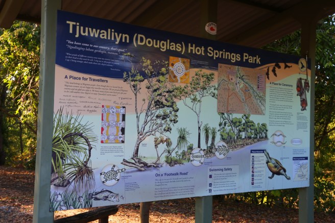
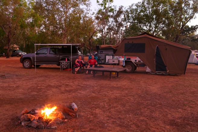
Douglas Hot Springs. Sites were 6.60 per person per night (honesty box).
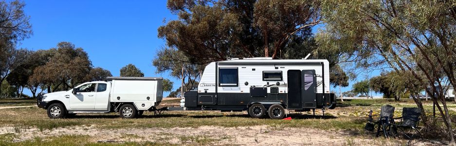
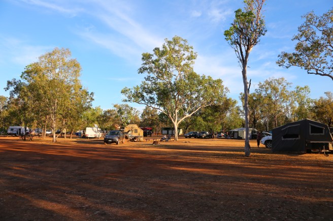
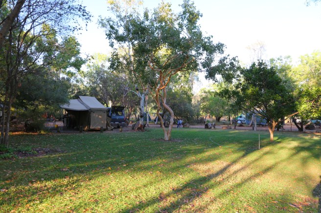
We made our way to Tjuwaliyn (Douglas Hot Springs) National Park situated on the Douglas River. It is about 200km south of Darwin. The directions say if travelling south to take the old Stuart Highway (the scenic route) we chose the entrance just south of Hayes Creek. The road is sealed all the way apart from the last 7km which is a formed gravel road. People were towing everything in, so not a problem at all. There were 2 creek crossings, the first one was dry but a bit sharp, so slow down for it. The second one had water in it but was very shallow with a rocky bottom. There is a very large Campground split into 2 one side for generators. Of course we chose the side where generators are not allowed.
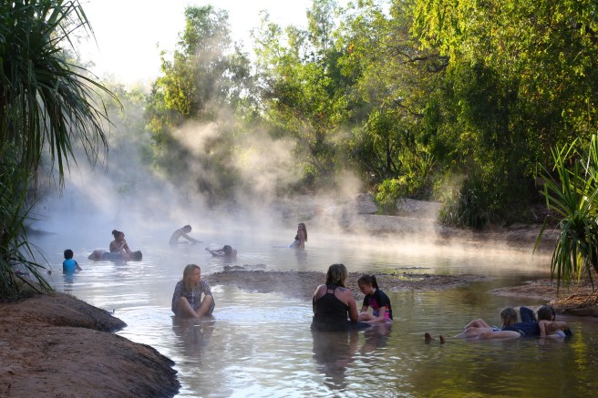
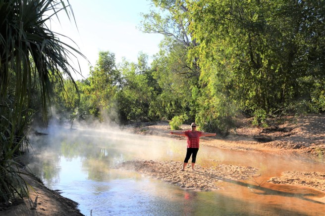
The campground had flushing toilets and a shower but the shower didn’t work. There were also water taps in the campground. The campground is very dry and dusty however, you are rewarded once you get down to the hot springs.
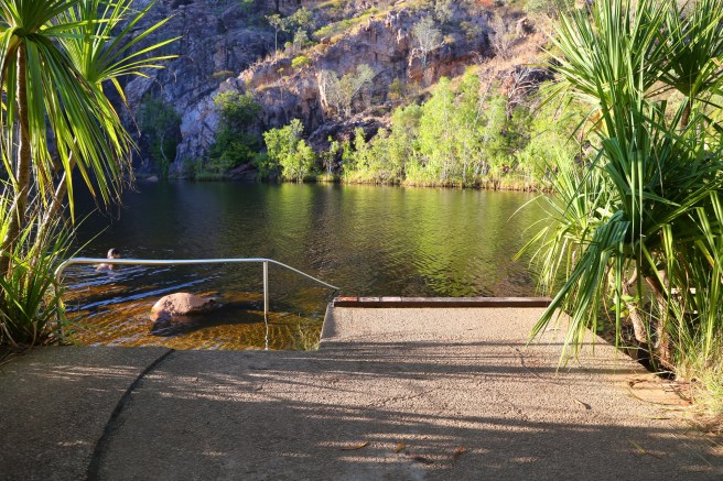
There are a few steps to negotiate down to the bank. I was in heaven, mostly ankle deep water and some places half way up your calfs. The water went from scalding hot to freezing cold to just perfect. If you got yourself in the right spot you could lay down and have your head in warm water and your feet in cool water. We were there over a weekend which was also the start of the NT school holidays which meant it was filled to capacity.
Edith Falls. Sites were $12 per person.
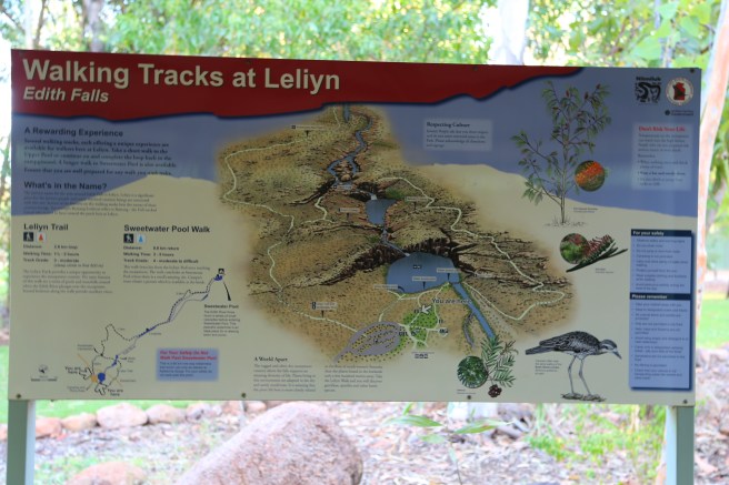
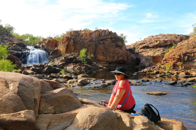
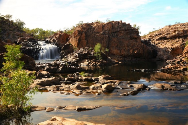
After our 2 nights at Tjuwaliyn (Douglas Hot Springs) we made our way to Edith Falls (Leliyn) campground in the Nitmiluk National Park. We had been warned by many people we spoke to and WikiCamps that you have to get there early. They don’t take bookings and is very popular. So we packed up and set off early, the campground is 20km in off the highway. Luckily, we noticed they had a sign at the beginning of the road saying what was available, so we carried on. We arrived about 11:30am and there were not many sites left, mainly small sites or tent sites.
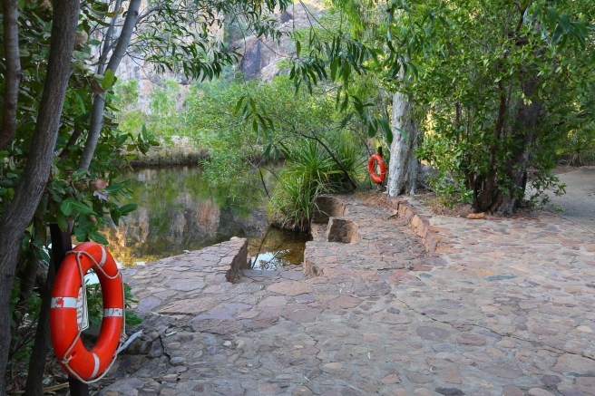
Such a well cared for campground with very clean amenities. After we set up we made our way down to the falls and main swimming area. We were so hot and couldn’t wait to get in, until our toes touched the water. Oh my goodness it was freezing. But as they say don’t dilly dally just get in….. so we did.
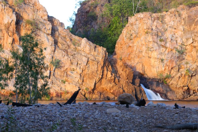
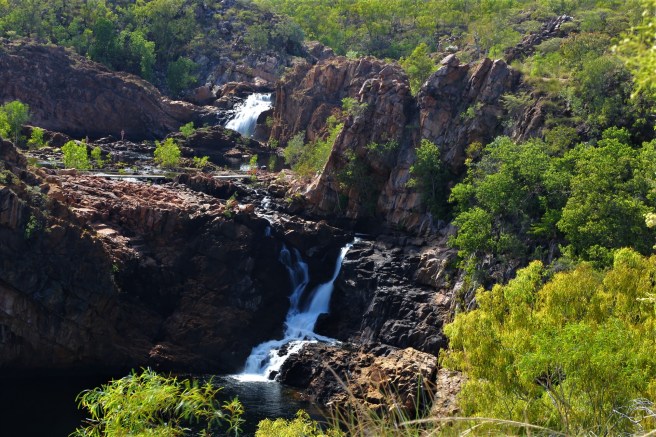
The next day we did the walk to the top falls and pools. It is a 2.6km loop walk. We were told to take the loop clockwise, so start from the car park which we did. By doing it this way you walk straight up a very steep path for 600m. You have a choice here of continuing on or head on another 3.5km (one way) walk to sweetwater pools further up. A bit further until you reach the upper falls and pools.


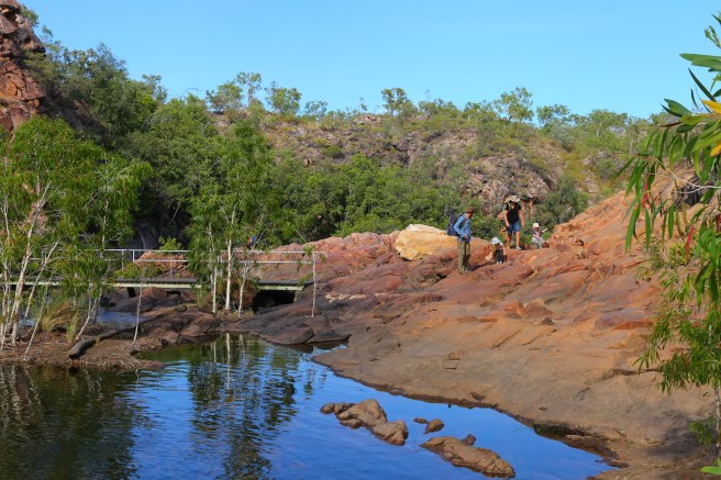
After having a lovely relax by the pools we continued the remaining 1.6Km walk back to camp. First you clamber up over rocks up the hill. The track was up and down but the last stretch was all downhill. I personally preferred going this way round but Chris said he probably would have preferred the other way.
Katherine
At this point we had to make a decision on weather to free camp near Katherine to top up supplies before heading along the Victoria Highway to Kununurra or stay in a caravan park. We decided we really needed to top up the batteries and to do some washing. So we chose to stay at a caravan park on the Victoria Highway about 10-15 out from Katherine called Manbulloo Homestead on a cattle station. Loads of shade and lots of grass sites, although we lucked out with grass and got dirt. It was so nice to stay in a place where everyone is happy and laughing (that is the staff) they made me giggle a few times. Amenities have been renovated and were very clean. I certainly was very happy with my choice. Powered sites were $35/night.

Sullivan’s campground. Sites were $3.30/person/night.
Our next stop was Sullivan’s campground in the Gregory National Park. This is a small campground just off the highway alongside a permanent waterhole, apparently with salties. This place is about 160 odd kms from Katherine. When we first arrived we thought we would just have lunch and move on. After we got talking to some people they said you better set up camp as you won’t get in anywhere by the time you get there. It seems you have to arrive at these places early to be guaranteed a spot. As we found out, we were boxed in by two people travelling together. Luckily they had a gorgeous border collie called Bill who kept us entertained for the evening, really just a male version of Mignon.

Big Horse Creek Campground. Site cost $3.30/person/night.
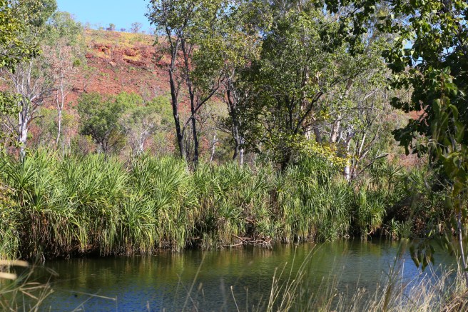
Big Horse Creek Campground is 10km west of Timber Creek. This a reasonable sized Campground in a circle with fire pits in the centre with all these Boab Trees. It has pit toilets. I quite like this one has appeal. But really smelly toilets. It is set against the Victoria River, we were quite surprised how wide the river is. It is as wide as the Murray River. Unlike the Murray River, this one is full of crocodiles (not that we saw any).


Wet set off early and arrived in the morning. Just as well we did we got a really good site with loads of shade. Shortly after arriving people with big caravans started piling in. There are quite a few Bower Birds here and we were fortunate to have seen their Bower. It was very cute with all the stones and bits of rubbish it has collected as a gift for the female. We watched him as he courted a female, strutting his stuff fluffing up his feathers to show his purple head and making all these noises. (He was never successful while we were there)

Our intention was to get up early and head off to Keep River National Park but we had very strong winds last night which kept me awake for most of the night. Luckily we are in no rush so decided to stay another day. After breakfast I had a knock at the tent and 2 ladies were there. One was a photographer the other the park ranger. They said they liked our set up and asked if they could take some photos for their website, which is being revamped. I said sure no problems then they asked if I would be in the photo with Stacey. Well instead of saying sure no problem my response was “only if I can my hair first” such a surreal experience. The funniest part for me, was that I had to sign a “talent release form” our one and only time to be famous. So you must check out the Northern Territories Park and Wildlife page once they put all their new photos in.


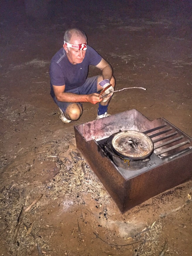
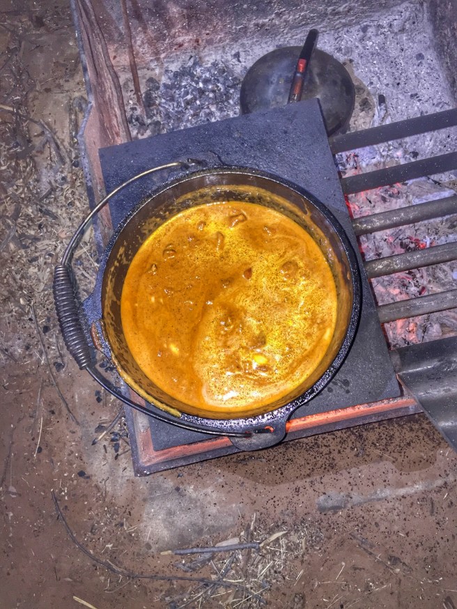
I channeled one my favourite chefs today and made Adrian Richardsons famous butter chicken. I must say it was delicious. This is one of the meals where I had pre-prepared the spice mix in a snap lock bag, definitely a winner.

Later that evening we went in search of a boab tree to get a good night time shot.

Keep River National Park – Gurrandalng Campground $6.60/night.
We were told it is very hard to get a campsite here and to get in early. So we set off and when we arrived we must have been fortunate as there were not a lot of people. There are 2 campgrounds here Gurrandalng and Jarnem. We chose Gurrandalng which is 18 km in on a dirt gravel road. The road in was not too bad with intermittent corrugations and sandy bits. There is one water crossing just as you are coming into the campground which is very shallow and and sandy patch just as you are coming out of it. You could easily get in on 2wd this time of year.

After setting up the people in the campsite came back and we got chatting. They invited us to sit around their campfire. They are Terri and John from WA. Turns out we are taking a similar path and the boys share the same interest in photography.
We set off early today for our walk from the cam Gurrandalng walk. It is a 2 km walk that weaves through the sandstone. We saw some magnificent sandstone formations. We were also lucky enough to see 2 red tail black cockatoos. Wow they were huge and so majestic. The walk is quite easy but if you leave too late in the morning, it is way too hot!


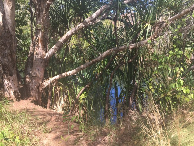
The next day we did the Jinumum walk. This is a 3km walk that follows the creek bed of the Keep River to a site once used by the Miriwoong people as a wet season shelter. As we were following the river bed I was wondering if there would have been crocodiles in there. Couldn’t see any but when we got back some other people said to us did you see the big saltie! Ah no we didn’t. Actually I’m glad I didn’t, I’m not sure I could have walked any further knowing that. That evening we went with Terri and John to Cockatoo Lagoon to take some sunset shots. This is near the rangers station where you can read all about the area and collect some brochures. The lagoon was amazing full of bird life.


It was so hot today and we struggled with the heat. Decided not to do the Jarnem walk which is a 7km walk. In the evening we did the Ginger’s hill walk which is a short walk that leads to a typical stone structure built by Aboriginal groups.

The sign down the bottom said its purpose is revealed at the top of the hill. Unfortunately, the sign has been damaged by the burn offs. However, from what we can work out it is a structure that they used to capture birds of prey for eating.
We went on the guided ranger walk with Christian today. What a talented and interesting young man. He has been learning the different aboriginal dialects and speaks them very well. He has been studying their way of life and was just so knowledgeable. I love listening and talking to people who are just so passionate about what they do. He certainly is an asset to the department.
Lake Argyle Resort $35/night unpowered
We said our goodbyes to Terri and John and headed towards Lake Argyle Resort and caravan park. First we had to make sure we had disposed of all our fruit and vegetables and honey before crossing the border into Western Australia. I had met another couple from South Australia heading east so I gave them our honey (locally made in Walker Flat) such a shame to throw it out as it was very nice. When crossing the border you can’t take any fruit and most vegetables. You can take sweet potatoes and your carrots if you top and tail them. Same with garlic, if you peel them and top and tail them all good. I also found out that our lemons which I cut up would have made it in if I had taken the skins off! You also can’t take walnuts in their shells. The best place to find out what you can and can’t take in, is the departments website.
So we made it into Lake Argyle, once again we were told they were busy and to get there early. They only take 10 bookings per day. After that you just have to turn up and get a unpowered site. You speak with someone in the car park who looks at your rig and they decide where you can go. Then you take a little note into reception and make your payment. The girls then put a paper wrist band on you, which you must keep on the whole time! They are colour coded so staff know if you are an in house guest or a day visitor. You have access to very nice drinking water here.


They have a resident singer Steve Case who sings out on the grass as the sunsets, then goes into the bistro and sings while people are enjoying a meal.

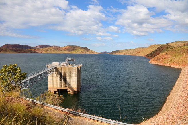
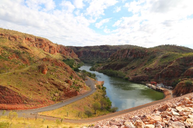
The next day we took a drive to the dam wall and checked out the view from the water tank lookout. This was no more than kilometer or so drive.

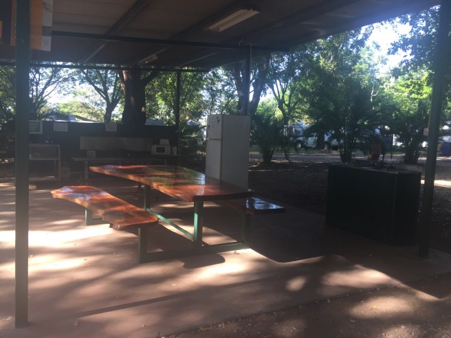
This road continues on down a Steep hill to an oasis by the river and the hydro power station. This picnic area, has loads of shade, toilets and picnic tables. It was very well cared for and so cool under the canopy of the trees.


Today we did the lunch time cruise on Lake Argyle. It was very interesting the lake is so big with lots of little islands. Unless you know where all the submerged rocks are it is best to have sonar or you would be in a lot of trouble. We pulled in to see a wallaby when we were fortunate to see a little freshie.
 We were also fortunate to see a rock they call Jabiru rock it had a Jabiru sitting in its nest looking after her baby. We finally made it to our destination on an island. As I can’t remember the name of this island we will call it spider island. All the trees had these huge webs spun from tree to tree. So in the water we went off the back of the boat, while the crew cooked lunch. How divine, the water was a good temperature and it is so soft felt just beautiful on your skin.

We paid a visit to the Durack Museum after the boat ride. Very interesting and lots of memorabilia of the Durack family. This house was originally in the valley that they flooded to make Lake Argyle. So they dismantled the house stone by stone and numbered each stone so they knew where to put them when they rebuilt it. Unfortunately they ran out of money so the stones sat for many years in bags and with all the rain and humidity the numbers wore off! So they put it together from what photographs they had.
That evening we made our way to Pannikin Bay sunset lookout. This is most definitely a 4×4 track, you can drive the 1.5km in and park your car and a short walk up the hill as we did. Or if you have high clearance drive to the top there is a small turn around at the top. The road is not marked and is about 250 meters past the turn off to the Durack Museum. This track winds up onto the sandstone ridges overlooking Pannikin Bay, Gundarim Ridge and the Mathewson Ranges to the north east. We were not disappointed with our sunset views it was most spectacular. Apparently the view is often used in television magazine marketing campaigns around the round. It most definitely did not disappoint.


With being across the border now our time has gone back 1 and 1/2 hours and our days start very early around 5:30 – 6am, before you start saying no way (Chris and Sharon would never be up that early) I can assure you we are. It is the coolest part of the day it has certainly taken us a long time to adjust. The day seems to go on and on and then around 5ish it goes down. It is still very hot, you just don’t have the very hot sun directly on you. Every day so far has been around 35c, so if you don’t have a pool or a gorge to swim in then the heat just zaps all your energy.
Next day we were off to Kununurra.

Very very interesting, loved the photos, reading your blog made Dad andI feel like we were there with you,
LikeLiked by 1 person