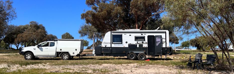

After a top of up fuel at Marree and some last minute supplies from their very well stocked General Store we set off.
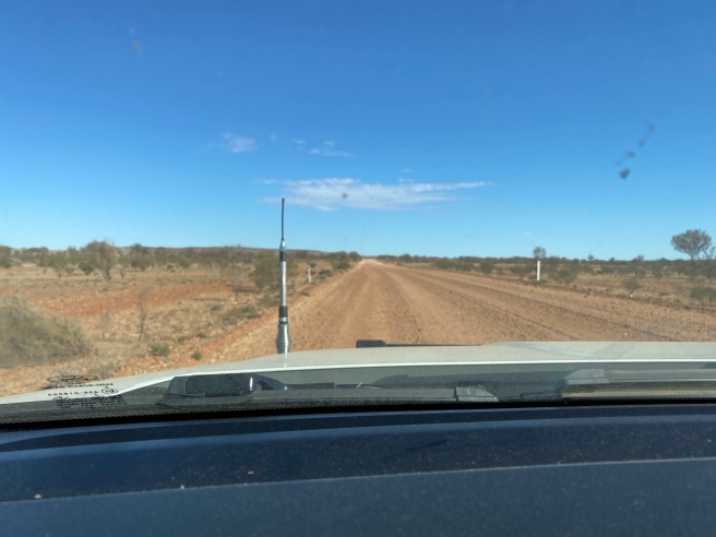
We travelled the Oodnadatta Track a few years ago during a very wet winter which made for an interesting and slippery journey. This year was extremely dry and the roads were in a remarkably good condition but not so for some sections.

The Oodnadatta Track starts at Marree at the southern end and ends at Marla the northern end. It is about 620km long and is a very well maintained gravel road. The track follows an Aboriginal trading route and there are numerous springs feeding water from the Great Artesian Basin, which was the reason why this route was chosen for the steam-train powered Central Australian Railway, the original route for The Ghan.
Building of the tracks were between 1878 and 1929, it started at Port Augusta and ended at Alice Springs on a 1067mm narrow gauge. The ill fated line suffered many accidents, floods and damage plus ongoing water issues for the steam trains, so the entire railway was retired in 1980 with the commencement of a standard gauge line when the Tarcoola to Alice Springs line opened.
An attraction for us along the Oodnadatta Track are all the bridges, Fettlers Cottages, water towers / water softeners (desalination towers) and railway sidings. During its time these would have been bustling with people under very harsh conditions. Today, some are still standing albeit not much and some have endured some very harsh conditions but are remarkably preserved.
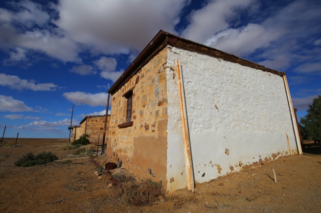
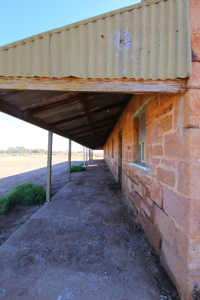
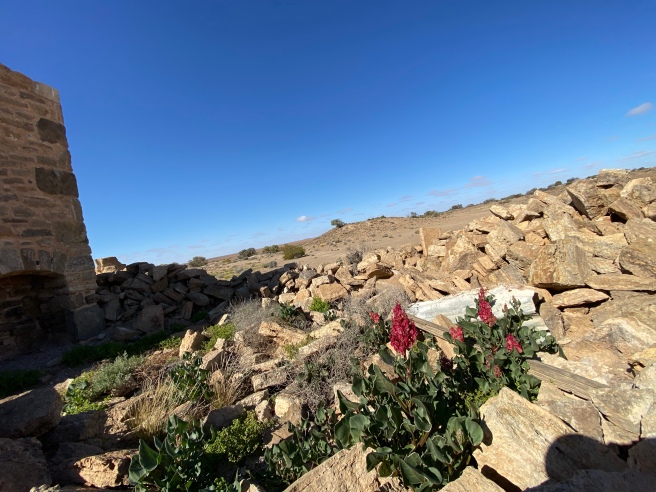
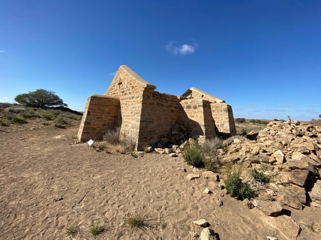
First set of ruins we found after Marree is Wangianna and all that remains are the Fettlers quarters. They are in pretty good condition considering when they were built.


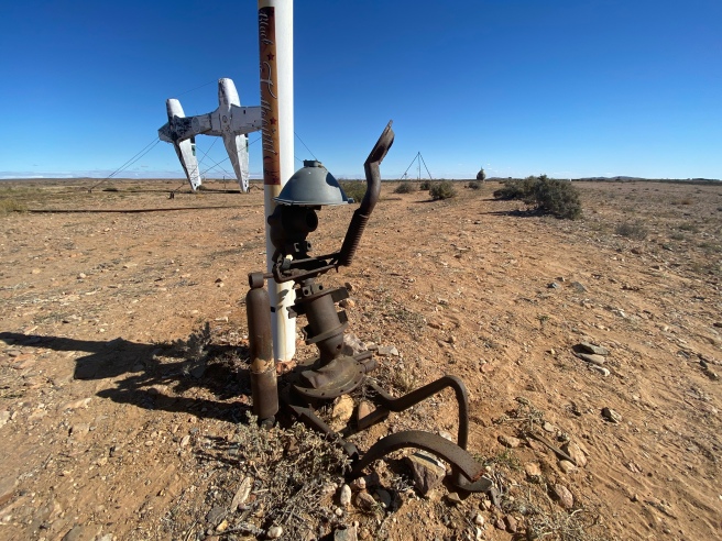
Mutonia sculpture park near Alberri Creek, a mechanic come artist local has collected what some people call rubbish and he has made quirky sculptures out in this extremely flat landscape. Some say it was inspired by Mad Max.


Lake eyre lookout is the only chance you have of seeing the lake along the track and without taking one of the tracks out to the lake. We stopped here for lunch and a break and as usual blowing a gale.

Curdimurka railway siding dating from 1888 is always a favourite of mine and is still in really good condition albeit the normal graffiti and destruction over the years.. West of the siding is a water tower and bridge however we were unable to gain access to these as they are behind a fence on private property. This siding has been the place for the Curdimurka Ball since 1986 where men arrive in tuxedos and woman in ball gowns. I know I would love to attend one of these balls, how magical would it be dancing under the stars in the bush in your gown and hiking boots. It would be heaven.
Coward Springs was where we had planned to stay the night, however they had a sign out the front saying they were full. So unfortunately we did not have the chance to experience Coward Springs this time.
Beresford Siding is another set of cottages still in really good condition, let’s hope they stay this way for a long time to come. We camped here the night, it is well back from the road and accessed behind the dam. Plenty of places to camp and be by yourself around the water. There is a water softener and tower there as well.


Strangways Springs was first discovered by the European explorer Warburton in 1858 and during geological times the natural flows of water from the Great Artesian Basin were much greater than they are today. There are many active springs and sadly many are now only a trickle of water or have dried up. Strangways Springs is on the Anna Creek Pastoral Lease. Strangways has a long history, in 1862 a Pastoral Lease was signed and large amounts of ewes, rams and cattle had arrived. Sadly there was a severe drought and by 1865 half of the livestock had died. At the end of the drought a small town was established with a dry stone wall for the stock yards, wool shed, kitchen and living quarters among many others. In 1870 the Overland Telegraph Line commenced from Port Augusta to Port Darwin and Strangways was selected for a repeater station to be installed. Then in 1882 plans were announced to extend the Great Northern Railway from its terminus at Farina. five to six hundred unemployed men were deployed from Adelaide and temporarily resided at Strangways while the line was extended.


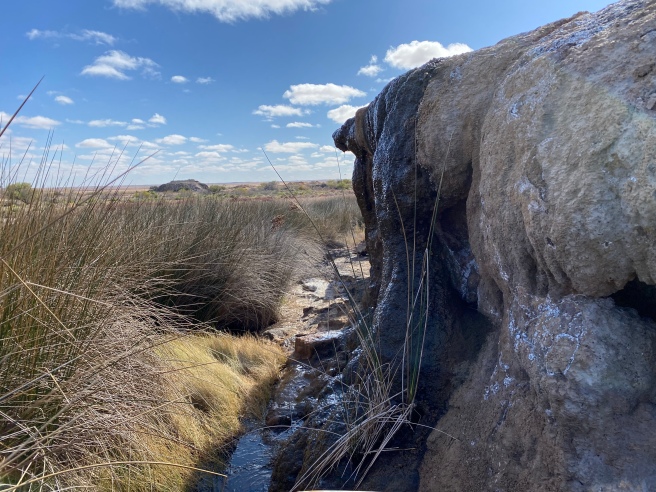
Flora and Fauna has evolved within a desert environment. There are many mounds and with the many bores drilled into the Great Artesian Basin, many have also ceased to flow. With the mounds that still flow today they support a diverse wetland and an array of vegetation and aquatic plants. The fauna include four species of invertebrates only found in the mound springs area. Therefore, it was essential to fence off this unique area to keep stock and other animals out and the forever increasing off-road vehicles. As such you are welcome to walk around the area and there are three easy walks to allow you to see the mounds and the natural rich history of the area.
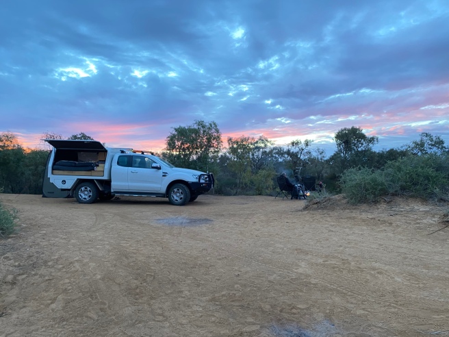
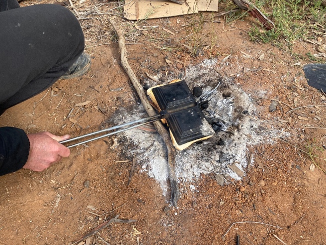
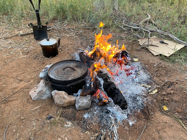
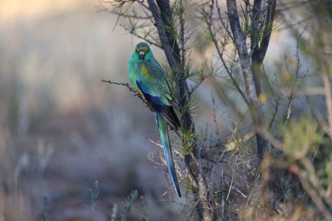
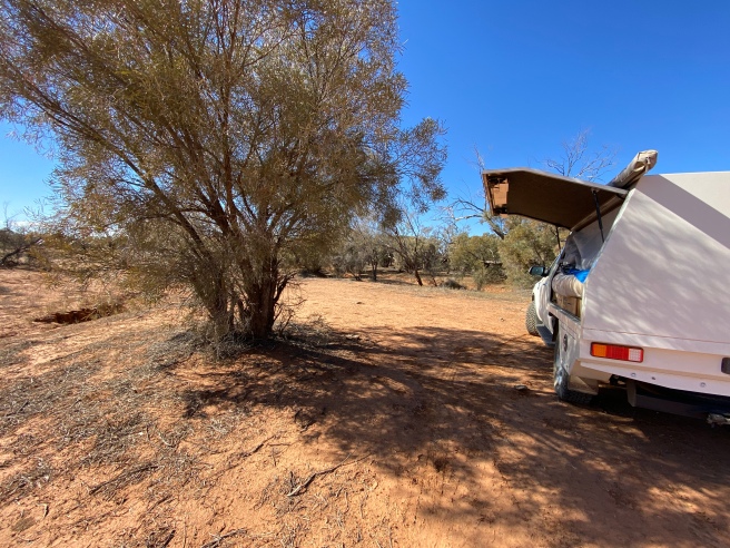
We hadn’t travelled very far when we found the Warriner Creek Bridge crossing over Warriner Creek.We pulled in off the road for a bit of exploring and found water in the creek that was it, Chris is pulling out the camera in search of birds to photograph and before we knew it we are setting up camp. Such a wonderful spot, so quiet and interesting walking along the water and exploring the area. You really appreciate how lonely and harsh conditions would have been living out here in the 1880’s. Treated to a nice sunset we set about cooking our dinner and settling in by the fire for the evening.


Mesa Lookout
Mesa Lookout – Old Ghan Railway – Oodnadatta Track

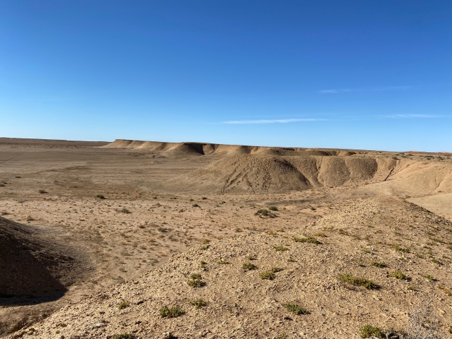
We hadn’t travelled very far when saw a sign to the Mesa Lookout. It really looks like you are looking at the craters of the moon a very interesting place to stop and look at. There were signs everywhere advising not to walk on the fragile area. We took some photos and then moved on.
William Creek Hotel
William Creek Hotel is always an interesting place to stop for a look around, top up with fuel or food supplies. If you wish you can book a scenic flight over Lake Ayer here.
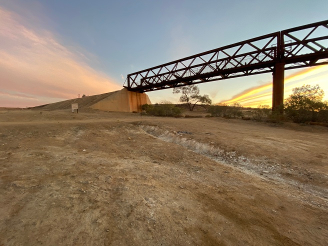
Duff Creek Bridge
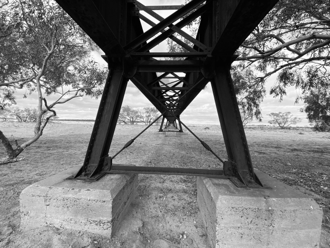
Once again we were amazed at the engineering and sheer hard work these works people endured building these bridges so the train could carry on when the area was in flood. Unfortunately many times the floods were just too much and many times tracks and bridges would be destroyed and people would have to go back out to repair. Must have been an endless task in these harsh conditions.
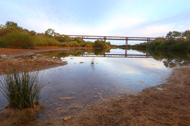
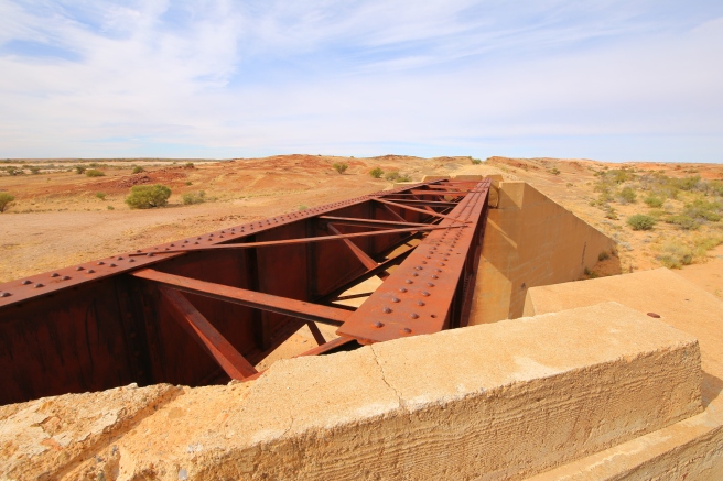
Algebuckina Bridge – Free Camp
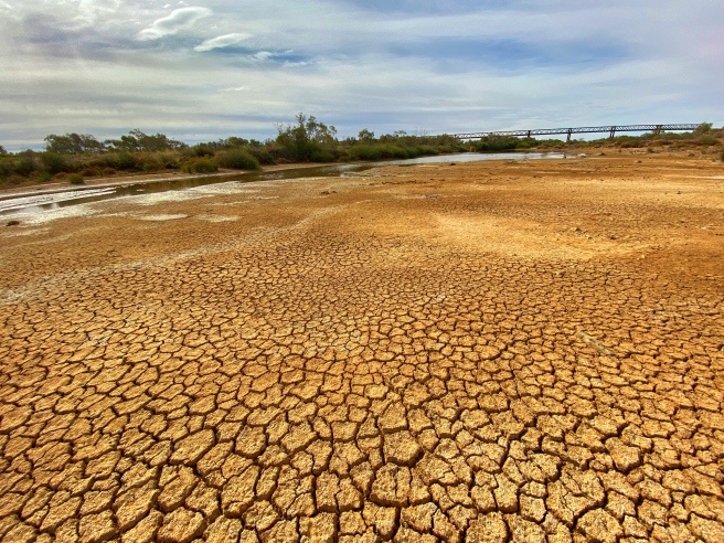
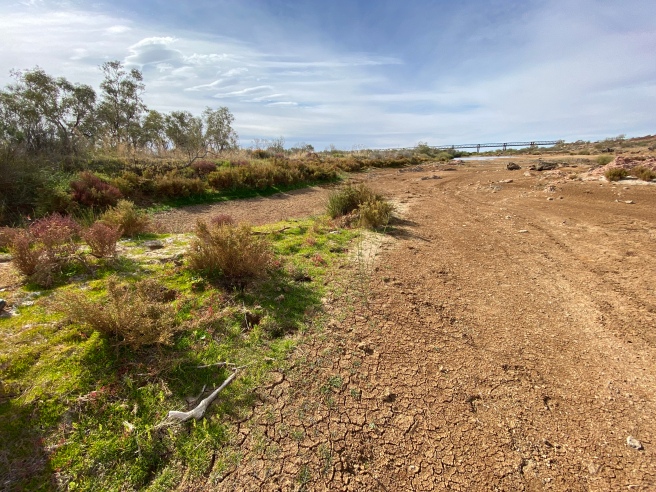
This is by far the most amazing bridge to see. It was officially opened in 1892 and was the longest bridge in South Australia at an amazing 587 meters consisting of 19 spans. It crosses the floodplains of the Neales River and many men died whilst building this bridge. It is always a great place to stop, rest and explore. You can walk over the other side and many different plants and landscapes to explore. Just need to be careful where you are walking so as not to destroy the plants.
Algebuckina Bridge – Old Ghan Railway – Oodnadatta Track


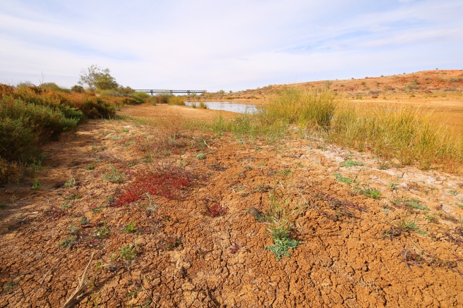
Algebuckina Waterhole our shortest yet move from camp sites!
After a very peaceful evening we set off towards Oodnadatta and noticed directly across from where we were a sign and a gate. To our surprise there is a waterhole with many types of birds and loads of free camping by the waterhole. This is on private property but you are welcome to camp there. Just need to keep the gates shut.


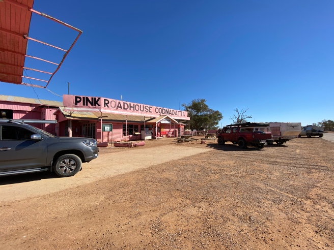
Oodnadatta Roadhouse
This final stretch of the track to Marla has proved to be quite devoid of very much at all. However, we were pleasantly surprised when we stumbled across Kathleen Creek. What a find! There are places to camp either side of the river and a bonus with plenty of bird life.


No water in Olarinna creek but would also be a lovely place to camp if there was. It was so dry, so we set about having some morning tea and continued along the track.
Driving from here onwards there really isn’t much more to see, so we set about playing with the drone and managed to get some footage of us along the track.
The end of the line for us was when we reached Marla and spent our time doing our cross border forms to allow us to cross into the Northern Territory as we hadn’t had any service prior to that.
